
Home Blog Page 5

India’s New High-Altitude Eye: HAPS Set for Full-Scale Test Flight

0

India is preparing to take a major step into the stratosphere with the full-scale flight test of an indigenous High-Altitude Pseudo-Satellite (HAPS) developed by CSIR–National Aerospace Laboratories (NAL). The platform is designed to combine the persistence of a satellite with the flexibility of an aircraft—potentially giving India a powerful new tool for surveillance, communications and border monitoring. 

🛰️ A “Satellite” That Takes Off Like an Aircraft

HAPS is not actually a satellite. It is an ultra-light, solar-powered unmanned aircraft designed to operate in the stratosphere, far above normal commercial aviation.

NAL’s full-scale platform is being designed to climb to around 23 km (75,000 feet) and remain airborne for at least 90 days. Its planned 33-metre wingspan is roughly comparable to that of a Boeing 737, highlighting just how ambitious the platform is despite its extremely lightweight construction. 

🔹 Solar cells mounted across the wings provide daytime power.

🔹 Batteries are intended to keep critical systems operating through the night.

🔹 The aircraft can remain over a designated geographical area for prolonged periods instead of repeatedly returning to base.

👁️ Built for Persistent Surveillance

The biggest attraction is endurance. Conventional drones are constrained by battery life, fuel and operating altitude, while satellites follow predetermined orbital paths.

HAPS could occupy the middle ground.

🔹 Border surveillance: Persistent observation of sensitive frontier regions.

🔹 Maritime monitoring: Tracking activity across strategically important sea areas.

🔹 ISR missions: Intelligence, surveillance and reconnaissance over extended periods.

🔹 Communications: Acting as a high-altitude relay or a potential “tower in the sky.”

🔹 Disaster response: Monitoring floods, cyclones and other large-scale emergencies.

Operating in the stratosphere also places HAPS above most commercial air traffic and many weather systems, creating a relatively stable environment for long-duration missions. 

🧪 From Prototype to Full-Scale Aircraft

India has not jumped directly to the giant platform. NAL has been progressively testing smaller demonstrators.

A scaled solar-powered prototype previously reached about 7.5 km and demonstrated more than 10 hours of endurance. These trials helped researchers validate aerodynamic performance, lightweight structures, solar-energy systems and flight-control technologies needed for the much larger aircraft. 

The upcoming full-scale test is therefore more than another flight—it is a critical technology milestone.

🇮🇳 Why This Matters for India

India is simultaneously expanding its space-based surveillance capabilities, including plans for a large military satellite constellation. HAPS could complement those assets rather than replace them, providing a platform that can be repositioned and maintained without a conventional satellite launch. 

The strategic advantage is simple: stay high, stay longer, and keep watching.

The HAPS programme represents India’s attempt to establish a new layer between drones and satellites. If the full-scale aircraft successfully demonstrates its altitude, endurance and payload capabilities, it could open the door to persistent surveillance and communications platforms designed and manufactured domestically.

The real breakthrough will come not merely when HAPS flies—but when India proves that an aircraft can effectively turn the stratosphere into a permanent surveillance and communications layer.


🇮🇳 India Doubles 5G Radiation Limit: What Changes Now?

India is preparing for a major shift in its telecom rules. The government is set to double the permitted electromagnetic-field (EMF) power-density limit for 5G base stations from 5 W/m² to 10 W/m², with the revised rules expected to take effect next month. 

The move is designed to make 5G deployment more efficient—but it also puts the spotlight firmly back on radiation standards and public safety.

⚡ What Exactly Is Changing?

📡 The new rules would allow a 5G base transceiver station (BTS) to operate up to 10 watts per square metre, compared with the current 5 W/m² ceiling.

🔎 Importantly, this is a limit on radio-frequency electromagnetic-field exposure from base stations, not a statement that mobile phones themselves will suddenly emit twice as much radiation.

🌍 The government is positioning the change as an alignment with international norms. Reports say the revised ceiling corresponds with the level recommended by the International Commission on Non-Ionizing Radiation Protection (ICNIRP) and is used in numerous countries. 

🗼 Why Telecom Companies Wanted This

5G networks depend on dense infrastructure, particularly in busy urban areas. More capacity and coverage can require additional sites, creating higher deployment and capital costs.

🚀 A higher permitted power density could allow signals to cover a larger area from an individual site.

🏗️ That could reduce the number of additional towers or small-cell sites needed in some locations.

💰 Fewer new sites can potentially translate into lower network-expansion costs for operators.

📶 For consumers, the intended payoff is better coverage and more consistent network performance as mobile-data demand continues climbing. 

🧬 Does “Double the Limit” Mean Double the Health Risk?

Not necessarily—and this distinction is crucial.

The 10 W/m² figure is a regulatory exposure ceiling, not the amount every person will experience. Actual exposure depends on factors such as distance from antennas, antenna direction, equipment power, surrounding structures and network traffic.

🇮🇳 India’s telecom authorities also maintain compliance mechanisms. The Department of Telecommunications says BTS sites must meet prescribed EMF limits, submit self-certification and remain subject to compliance audits by its field units. 

🧪 DoT states that EMF exposure from mobile towers below prescribed ICNIRP/WHO-recommended limits has no convincing scientific evidence of causing adverse health effects. 

📈 The Bigger 5G Picture

This is ultimately about network economics as much as radiation policy.

India’s 5G usage is expanding rapidly, while operators are under pressure to deliver greater capacity without endlessly multiplying infrastructure.

🔹 Jio and Airtel could potentially improve coverage efficiency across their existing networks.

🔹 Vodafone Idea, which is expanding its 5G footprint, could also benefit from greater flexibility in network planning. 

🔹 For the industry, the change could mean more coverage per site, lower incremental infrastructure requirements and potentially faster expansion.

⚠️ What Should People Watch Next?

The real test begins when the revised rules take effect.

👀 Regulators will need to ensure operators remain within the new limits.

📊 Independent monitoring and transparent exposure measurements will remain important for public confidence.

📡 And as India moves toward increasingly advanced mobile technologies, the debate will continue: How much infrastructure does a connected nation need—and how should exposure be regulated?

India is not simply “turning up 5G.” It is redrawing the regulatory boundary around telecom infrastructure to make nationwide connectivity more efficient. The challenge now is to deliver that bigger network while keeping compliance, monitoring and public trust equally strong. 

🌍 Earth’s Mysterious 26-Second Pulse

What if our planet has a rhythm we cannot hear—but scientists can detect?

For more than six decades, sensitive seismometers have been recording an extraordinarily regular seismic signal: a faint pulse that repeats roughly every 26 seconds. It is far too weak for humans to feel, yet instruments around the world can detect it. The phenomenon is real—but its precise cause remains unsettled. 

🔴 A “Heartbeat” Hidden Beneath the Noise

Scientists classify the signal as a microseism—a tiny, continuous vibration that forms part of Earth’s background seismic activity. Unlike an earthquake, it does not represent a sudden rupture of the crust, and it poses no known danger to people or buildings.

What makes this particular microseism extraordinary is its remarkably narrow, persistent rhythm. The signal has a period of about 26 seconds, equivalent to a frequency of roughly 0.038 Hz—far below the range of human hearing. Yet seismic instruments are sensitive enough to capture its faint vibrations travelling across enormous distances as surface waves. 

🌊 The Clue Pointing Toward the Ocean

The mystery became more intriguing when researchers traced the signal to the Gulf of Guinea, off the western coast of Africa, with later studies narrowing the source toward the Bight of Bonny.

One leading explanation involves the ocean itself.

🌊 Powerful ocean swells can interact with the continental shelf and seafloor, transferring energy into the solid Earth.

🌍 That interaction may create a repeating vibration that travels outward through the crust—almost like tapping a gigantic drum.

⛈️ Researchers have also found links between the pulse’s strength and storm activity, supporting the possibility that ocean conditions influence the signal. 

🌋 But There’s Another Suspect: Volcanoes

The ocean theory is not the only contender.

🌋 Some researchers have proposed that volcanic activity near São Tomé could generate the remarkably regular vibrations. Underground movement of fluids through cracks or volcanic conduits can produce persistent seismic signals, and research has specifically explored fluid-filled underground structures as a possible mechanism for the 26- and 28-second tremors. 

Researchers at the University of Hamburg have also highlighted the continuing debate between ocean-wave activity and volcanic processes. 

🧠 Did Scientists Really “Discover” It Recently?

Not exactly.

The pulse was first documented in the early 1960s, when geophysicist Jack Oliver identified a persistent seismic signal associated with the southern Atlantic. Decades later, improved digital seismic networks allowed researchers to revisit the phenomenon and pinpoint its source much more precisely. 

That is what makes the story remarkable: Earth has apparently been “ticking” for decades, while scientists are still debating what mechanism keeps the rhythm going.

🧬 Is Earth Actually Alive?

Here the science needs a clear boundary.

The 26-second pulse does not prove that Earth is a living organism. “Heartbeat” is an evocative metaphor, not a biological diagnosis. There is currently no evidence that the planet possesses consciousness, a biological circulatory system, or a literal heartbeat.

But the phenomenon does reveal something fascinating: Earth is never completely still.

Oceans, atmosphere, volcanoes, tectonic processes and the crust constantly exchange energy. Even when our planet appears silent and motionless, sensitive instruments reveal a world in continuous vibration.

After more than 60 years, scientists know where the signal is coming from—but not conclusively why it keeps beating so precisely. And perhaps that is the most fascinating part.

Earth isn’t necessarily alive. But it is undeniably active—and somewhere beneath the Atlantic, its quiet 26-second rhythm continues. 

Gurugram May Get India’s Tallest Tower

0

Gurugram’s skyline could soon be heading into a completely new league. Haryana is planning a 620–700 metre mixed-use tower inside the ambitious Global City Gurugram project—an idea that, if realised at the upper end of the proposed height, would make it taller than Shanghai Tower and transform the NCR skyline.

🏙️ A 700-Metre Landmark for Global City

The Haryana government has identified a 6.7-acre plot within the proposed 1,000-acre Global City for the landmark structure. The planned tower is being considered as a mixed-use development, although its final design, height and detailed programme are yet to be confirmed.

The proposal has emerged from discussions with developers and industry stakeholders to assess market demand, infrastructure requirements and global best practices for creating an internationally competitive landmark.

At 620–700 metres, the building would not simply add another skyscraper to Gurugram—it could redefine the city’s visual identity.

🌏 Shanghai Tower Could Be Overtaken

Here is where the proposal becomes globally significant.

Shanghai Tower in China rises 632 metres. Therefore, a Gurugram tower built at 620 metres would remain slightly shorter, but a structure reaching the proposed 700-metre mark would rise around 68 metres higher than Shanghai Tower.

That distinction is crucial: 700 metres is not yet a confirmed final height, so claims that the project will definitely surpass Shanghai Tower should be treated as a possibility rather than a certainty.

If the full height is achieved, Gurugram would suddenly have a skyscraper competing on a global scale.

🇮🇳 From India’s 320 Metres to 700

The scale becomes even more dramatic when compared with India’s existing skyline.

India’s current tallest completed building, Palais Royale in Mumbai, stands at about 320 metres. A 700-metre Global City tower would therefore be more than twice its height.

For Gurugram itself, the transformation would be even more striking. The city’s existing skyscrapers are nowhere near the proposed 700-metre category, meaning the project could create an entirely new vertical benchmark for the region.

🌆 More Than Just a Skyscraper

The tower is being planned as part of the much larger Global City Gurugram, rather than as an isolated building.

The official project vision includes premium workspaces, residential towers, retail, social infrastructure, green spaces, water bodies and multimodal connectivity. The development is being positioned as a self-sustaining, smart urban district designed around international planning practices.

🚇 Connectivity: The location near the Dwarka Expressway is expected to strengthen links between Gurugram, Delhi and the airport.

💼 Business: Global City is envisioned as a new central business district capable of attracting major companies and investment.

🌳 Urban planning: Green spaces, water bodies and integrated infrastructure are central to the larger development.

⚡ The Biggest Question: Will It Actually Rise?

The headline number is spectacular—but the project is still at the planning/proposal stage.

The Haryana government has been working on the wider Global City development and has also sought professional support for its monetisation. Recent government directions have focused on foundational infrastructure such as water and power, while officials have been asked to prepare a blueprint for an iconic tower.

That means the 700-metre vision should currently be viewed as an ambitious proposal, not a building already under construction.

If Haryana manages to turn the concept into reality—and reaches the upper end of the proposed height—Gurugram could move from being India’s corporate skyscraper hub to becoming a genuine global supertall destination.

For now, the tower remains a bold promise. But if 700 metres becomes concrete, the NCR skyline will never look the same again.

🇮🇳 India’s First Virtual Zoo Opens in Indore

0

Indore is taking the zoo experience beyond cages and enclosures—with technology turning wildlife into an immersive digital adventure.

🐅 A Zoo Where Wildlife Comes Alive

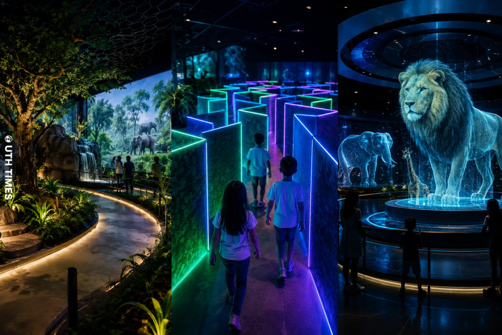
The Kamla Nehru Zoological Garden in Indore has introduced a high-tech virtual wildlife experience featuring a state-of-the-art 14D theatre, virtual jungle safari and digital attractions. Zoo authorities and civic officials have described the facility as a first-of-its-kind digital zoo experience in the country.

Unlike a conventional theatre where visitors simply watch a screen, the 14D experience is designed to make audiences feel part of the action. Special effects can simulate environmental sensations such as wind, rain, water splashes, vibrations, motion and other physical effects synchronised with what is happening on screen.

🎬 From Watching a Jungle to Entering It

The biggest attraction is the immersive virtual jungle safari. Visitors can be transported into digitally created wildlife environments without physically entering a forest.

🌧️ Rain sequences can be accompanied by water effects.
💨 Wind effects recreate the sensation of moving through a jungle.
🎢 Motion-enabled seating adds movement to action sequences.
🌫️ Additional sensory effects make the experience more realistic.

The idea is to transform wildlife storytelling from something people simply see into something they can experience through multiple senses.

🧬 Holograms, Digital Garden and Maze

The project goes beyond the 14D theatre. A hologram zoo adds another futuristic layer, using three-dimensional projections to create the appearance of animals suspended in space. Visitors can also explore a Digital Garden, Digital Maze and Digital Experience Zone, creating a broader technology-driven entertainment and learning environment.

🌳 Digital Garden: Technology-led exploration of nature and wildlife.

🌀 Digital Maze: An interactive attraction designed particularly to make learning and exploration engaging for younger visitors.

🦁 Hologram Experience: Three-dimensional animal projections bring digital wildlife into the visitor’s surroundings.

💰 ₹4.5 Crore Project With a Bigger Vision

The facility has been developed under the Public-Private Partnership (PPP) model, with reports putting the project value at around ₹4.5 crore. The development also represents an effort to convert previously underused zoo space into a modern visitor attraction.

More importantly, the project is not positioned merely as an entertainment upgrade. Its larger objective is to bring together technology, wildlife education, tourism and conservation awareness in a format that can appeal to children, families and tourists alike .

🌏 A New Model for Wildlife Education

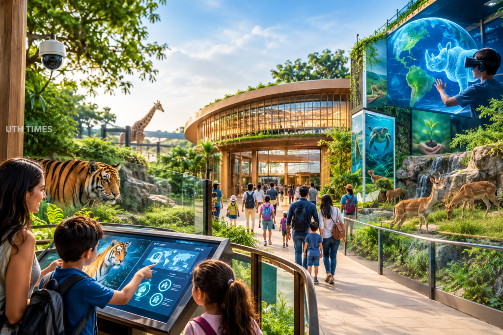
Indore’s virtual zoo points toward a changing relationship between technology and conservation. Digital simulations can recreate environments and animal experiences that may be difficult to provide through traditional exhibits, while giving visitors an engaging way to understand nature.

The result is a zoo experience built not only around seeing animals—but experiencing the world they inhabit.

From jungle trails to digital realities, Indore is giving wildlife education a distinctly futuristic face.

AI That Finds Bengaluru’s Potholes — and the Contractor Behind Them

0

Bengaluru’s pothole problem has entered a new technological era. An engineer has built an AI-powered system that does more than spot damaged roads—it can identify where a pothole is, document it and trace the government contract linked to the road.

🚨 From One Pothole to a Full Accountability Trail

The system was developed by Bengaluru engineer Gaurav Sen, who turned an everyday commuting frustration into a civic-tech experiment. Instead of depending on citizens to manually photograph potholes and figure out where complaints should go, the system automates much of that process.

At its core is a dashcam-based setup equipped with GPS and an accelerometer. As the vehicle moves through the city, the system continuously observes the road and uses AI vision models to identify potholes and classify their severity.

What makes the project particularly striking is what happens after detection.

🧠 AI Doesn’t Just See the Pothole — It Follows the Paper Trail

Once a pothole is identified, its location can be recorded along with photographic evidence. The system then searches a database containing around 2,900 government contracts to determine which road project and contractor are associated with that stretch.

🔹 AI vision identifies the pothole.
🔹 GPS pinpoints its location.
🔹 Contract data connects the road to its responsible contractor.
🔹 Automated documentation creates a complaint record containing evidence and relevant details.

According to reports, the system can generate this complaint record in roughly four seconds, dramatically compressing what would normally be a manual reporting process.

📍 One Commute, 12 Potholes

The system demonstrated its potential during a single commute when it reportedly detected 12 potholes. Instead of those 12 road defects disappearing into the daily chaos of Bengaluru traffic, each could become a documented, actionable record.

That distinction is important. The innovation is not simply another pothole-detection camera. It attempts to create a digital accountability chain—from road damage to responsibility.

⚡ Why This Could Change Civic Complaints

Bengaluru has already seen broader experiments with AI-powered road monitoring, including systems designed to map road conditions and prioritise repairs. One recent initiative surveyed about 1,600 km of roads using specialised cameras.

But the engineer’s approach tackles a different bottleneck: who should actually be held responsible?

If scaled and connected with official civic systems, such technology could potentially help authorities identify recurring problem areas, prioritise repairs and create stronger records of contractor performance.

The real breakthrough may not be AI recognising a crater in asphalt. Computer vision can already identify road defects.

The more ambitious idea is turning every damaged road into structured, traceable data—where location, evidence, contract and responsibility can sit within the same digital workflow.

For a city where potholes have become synonymous with frustrating commutes, Bengaluru’s latest experiment offers a powerful proposition: when technology can identify the problem in seconds, accountability may no longer have to disappear into paperwork.

Maitri-II: India’s Next-Generation Research Base in Antarctica

0

India is preparing to take its Antarctic research programme into a new era. The country plans to replace its ageing Maitri research station with Maitri-II, a modern, year-round scientific hub in East Antarctica, with the project now projected to become operational by 2032. (Press Information Bureau⁠)

The move is more than an infrastructure upgrade—it is a long-term investment in understanding one of Earth’s most important and rapidly changing environments.

🧊 Why Maitri-II Matters

India’s existing Maitri station was established in 1988–89 on the Schirmacher Oasis in East Antarctica. Built on an ice-free rocky area, the station has supported Indian scientific expeditions for decades and remains operational today. (NCAOR⁠)

But Antarctica is an unforgiving environment, and ageing infrastructure creates growing operational and research challenges. India’s new station is therefore being designed around modern scientific requirements, environmental standards and year-round operations.

🌍 The bigger objective: create a stronger Indian platform for long-term observations of climate, ice, atmosphere, ecosystems and geological processes.

🔬 A Laboratory at the End of the World

Maitri-II is envisioned as a state-of-the-art multidisciplinary research hub, rather than simply a replacement building.

🧬 Biology & Microbiology: A dedicated research suite will enable deeper studies of Antarctic organisms and microbial systems.

🧊 Glaciology: Advanced ice-core storage and processing will help scientists investigate historical climate conditions preserved within Antarctic ice.

🌡️ Climate & Atmospheric Science: Expanded atmospheric observation facilities will strengthen monitoring of climate processes and environmental change.

🌎 Earth Sciences: Researchers will be able to conduct broader geological and environmental investigations in the Antarctic region.

🚛 Logistics: A stronger logistics backbone is planned to support uninterrupted scientific operations throughout the year.

💰 The Project Takes Shape

The Ministry of Earth Sciences has approved ₹29.2 crore for pre-investment activities, including architectural design and preparation of the Detailed Project Report (DPR). The government estimates a seven-year timeline, placing expected completion around 2032 .

The proposed Maitri-II site has been identified in the Schirmacher Oasis, close to the existing Maitri station. Earlier planning included topographical surveys and a phased approach covering design, tendering, logistics, transportation and Antarctic construction.

🌐 India’s Scientific Signal to the World

Maitri-II arrives at a crucial moment. Antarctica is central to global discussions on climate change, sea-level rise, atmospheric circulation and environmental transformation.

For India, the station means something larger than a presence on the frozen continent: it provides a permanent platform to generate high-quality polar data and contribute it to international scientific research.

When Maitri-II becomes operational, India’s Antarctic programme will gain a significantly more modern scientific backbone—designed not merely to survive Antarctica, but to study it more precisely, continuously and ambitiously.

From frozen ice cores to atmospheric signals, Maitri-II could help turn Antarctica’s extreme environment into one of India’s most valuable scientific observatories.

Ladakh Gets Its First International Ice Hockey Rink

0

Ladakh has just added a major chapter to India’s winter-sports story. A ₹42-crore international-level artificial ice hockey rink at NDS Stadium in Leh has been inaugurated, giving local athletes something they have long needed: a professional ice surface that can operate throughout the year.

🏒 From Seasonal Ice to Year-Round Training

For Ladakh’s ice hockey community, the biggest breakthrough is not simply the new rink—it is the technology behind it.

🔹 The facility features a 24×7 mechanical chilling system, allowing the ice to be maintained even when natural winter conditions disappear.

🔹 Traditionally, players in Ladakh had only around two to three months of natural ice conditions for serious training and competition. That limited preparation time and made it difficult to build consistent, high-performance programmes.

🔹 With artificial ice now available throughout the year, athletes can follow structured training schedules instead of waiting for temperatures to fall.

That changes the sporting equation dramatically.

❄️ A ₹42-Crore Investment in Ladakh’s Sporting Future

The project represents an investment of approximately ₹42 crore, with government records putting the revised Detailed Project Report at ₹42.26 crore. The facility was inaugurated at NDS Stadium in Leh by Ladakh Lieutenant Governor Vinai Kumar Saxena.

🔹 The rink is designed to provide an international-level environment for training and competition.

🔹 Its all-weather capability can support longer sporting calendars, more tournaments and more systematic athlete development.

🔹 It also strengthens Leh’s position as a destination capable of hosting major winter-sport events.

The rink had already become an important sporting venue earlier in 2026, when the 6th Khelo India Winter Games used the artificial ice facility for its ice events.

🌍 Could Leh Become India’s Winter-Sports Hub?

The significance goes beyond one stadium.

Ladakh already has a strong connection with ice hockey, with players from the region contributing significantly to India’s national teams. The new facility gives that talent a more dependable pathway from local training to national and potentially international competition.

🔹 More training: Athletes can practise beyond the natural winter season.

🔹 More competitions: A reliable artificial surface makes tournament planning easier.

🔹 Better preparation: Players can train consistently for national and international events.

🔹 Greater opportunity: Young athletes can access a specialised sporting ecosystem closer to home.

The ₹42-crore rink is therefore more than a piece of sports infrastructure. It is an attempt to turn Ladakh’s natural advantage in winter sports into a year-round competitive ecosystem.

From frozen landscapes to an engineered sheet of ice, Leh is now building the infrastructure to make its ice-hockey ambitions last all year.

And for Ladakh’s young players, the waiting season is finally over. 🏒❄️

Sprite Tejas Express: Lucknow–Delhi Train Gets a New Brand Identity 🚆💚

0

India’s railway landscape is getting a striking new twist. The Lucknow–New Delhi Tejas Express is set to carry Sprite branding from August 13 to November 11, turning a familiar premium rail service into a moving advertising canvas.

A quick clarification: the train is not literally being transferred into private ownership. The Lucknow–New Delhi Tejas is operated by IRCTC under a pilot operating model, while the new Sprite identity is a branding/advertising arrangement.

🚆 A Train That Becomes a Brand

The transformation is more than simply placing an advertisement inside a coach. The Sprite association gives the Tejas Express a temporary branded identity, putting a globally recognised beverage brand directly onto one of India’s most recognisable premium train services.

🟢 Brand visibility: A train travelling repeatedly between Lucknow and Delhi offers exposure across stations, railway corridors and passenger touchpoints.

🟢 Limited-time campaign: The branding is scheduled for a defined period, making the train itself part of a seasonal marketing campaign rather than creating a permanent change to the service.

🟢 A moving billboard: Unlike conventional advertising, the train physically carries the campaign across two major urban markets, potentially reaching passengers and railway audiences along the route.

⚡ Why the Tejas Express Matters

The Lucknow–New Delhi Tejas Express has been operating since October 4, 2019, connecting the two cities over roughly 512 km. The service is an AC premium train with Executive Class and Chair Car accommodation and is operated by IRCTC in coordination with Indian Railways. (Wikipedia⁠)

Its positioning makes it particularly valuable for premium advertising. The Tejas brand itself was created around a more modern, upgraded rail experience, featuring amenities such as onboard infotainment, automatic doors, aircraft-style lighting and other passenger-focused facilities.

💡 India Has Seen Branded Trains Before

While the Sprite Tejas campaign is being described online as India’s “first private branded train,” that wording needs context.

Indian Railways has experimented with branded train exteriors for years. The Mumbai Central–Ahmedabad Double Decker Express, for example, received vinyl advertising in 2017 and was described as Indian Railways’ first branded train. Earlier campaigns also included the Kurkure Express and other branded services. (Wikipedia⁠)

What makes the current development notable is the combination of a premium Tejas service, a major consumer brand and a dedicated temporary branding identity.

This could signal a more aggressive future for railway advertising, where trains become large-scale media platforms rather than simply transportation.

🚉 For Indian Railways and IRCTC, such commercial partnerships can create additional non-fare revenue opportunities.

📣 For brands, trains provide something traditional billboards cannot: mobility, repetition and massive physical visibility.

💚 And for passengers, the Lucknow–Delhi journey is about to look considerably more “Sprite.”

One train. One route. One temporary identity — and a very visible experiment in the future of railway branding. 🚆🔥

Bhadla Solar Park: Rajasthan’s Giant Solar Powerhouse ☀️🇮🇳

0

Bhadla Solar Park is more than a vast field of solar panels—it is a powerful symbol of India’s renewable-energy ambitions. Located in Bhadla village in Rajasthan’s Jodhpur district, the park combines scale, intense desert sunlight and modern power infrastructure to turn one of India’s harshest landscapes into a major source of clean electricity. Rajasthan’s government describes it as a 2,245 MW solar project spread across more than 14,000 acres, making it one of the world’s largest solar parks.

☀️ Where the Desert Meets Technology

Bhadla’s location is a major advantage. Western Rajasthan receives exceptionally strong solar radiation and more than 320 sunny days a year, creating highly favourable conditions for large-scale photovoltaic generation.

🔹 Instead of relying on a single power plant, the park brings together multiple solar projects and developers across a huge, planned site.

🔹 Its enormous footprint allows thousands of solar modules to operate as part of a coordinated renewable-energy ecosystem.

🔹 The result is a striking transformation: land once associated with extreme heat and arid conditions has become a strategic asset in India’s clean-energy transition.

⚡ 2,245 MW of Solar Power at Massive Scale

The headline figure is its 2,245 MW installed capacity. That number places Bhadla firmly in the ultra-mega category of renewable infrastructure. Rajasthan’s official sources identify the park as the state’s 2,245 MW solar park, while a government presentation records its spread at approximately 14,085 acres.

🔹 The park’s development has involved multiple entities, including Rajasthan Renewable Energy Corporation Limited and its associated solar-park development structures.

🔹 Its scale demonstrates how solar power can move beyond small rooftop installations into infrastructure capable of contributing significantly to the electricity grid.

🔹 Bhadla also forms part of Rajasthan’s broader renewable-energy landscape, which includes major solar and wind clusters across the western part of the state.

🏜️ Why Bhadla Matters for India

Bhadla is significant not simply because it is huge, but because it represents a different model of energy development. India’s Solar Park Scheme was designed to create large, infrastructure-ready sites with facilities such as transmission systems, roads, water access and communications, allowing grid-connected solar projects to be developed more efficiently. 

🔹 Energy security: Greater renewable generation can diversify India’s electricity mix.

🔹 Lower-carbon growth: Solar electricity produces power without the direct combustion emissions associated with coal-based generation.

🔹 Infrastructure scale: Bhadla demonstrates how large renewable-energy zones can integrate generation with transmission and supporting infrastructure.

🔹 Economic potential: Such projects can stimulate investment, construction, operations and associated services in Rajasthan.

🌍 A Landmark in the Global Solar Race

Bhadla has become an international reference point for what utility-scale solar can look like. India’s renewable-energy expansion is accelerating, with the Ministry of New and Renewable Energy reporting 162.15 GW of cumulative solar capacity as of June 30, 2026.

Bhadla’s real achievement is not just the number of panels covering the desert. It is the idea behind them: turning abundant sunlight into strategic national infrastructure.

From Rajasthan’s blazing desert to India’s growing electricity grid, Bhadla Solar Park stands as a powerful example of how geography, engineering and clean-energy ambition can converge.

Bhadla is not simply harvesting sunlight—it is helping India build its energy future. ☀️🇮🇳