
, a solar-powered surveillance platform capable of operating in the stratosphere for months, boosting border security, communication, and intelligence capabilities.)
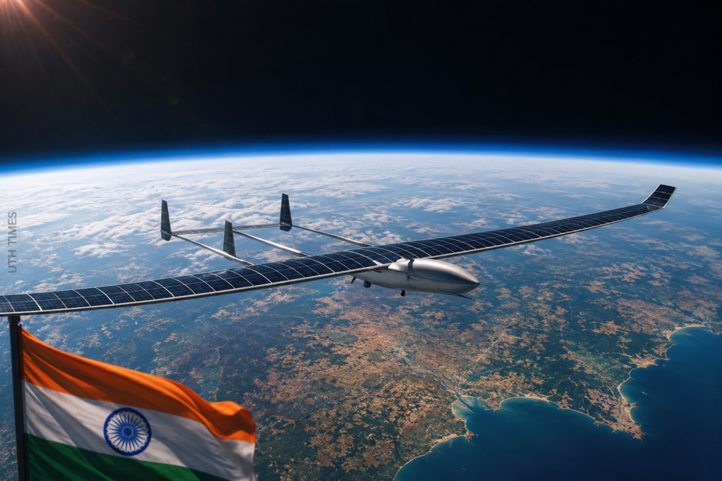
India is preparing to take a giant leap in aerospace and surveillance technology. The country is expected to soon conduct a full-scale test flight of its High-Altitude Pseudo-Satellite (HAPS), a futuristic aircraft designed to remain in the stratosphere for extended periods while performing intelligence, surveillance, and communication missions.
This breakthrough could redefine how India monitors its borders, oceans, and strategic assets.
🚀 What Exactly Is a High-Altitude Pseudo-Satellite?
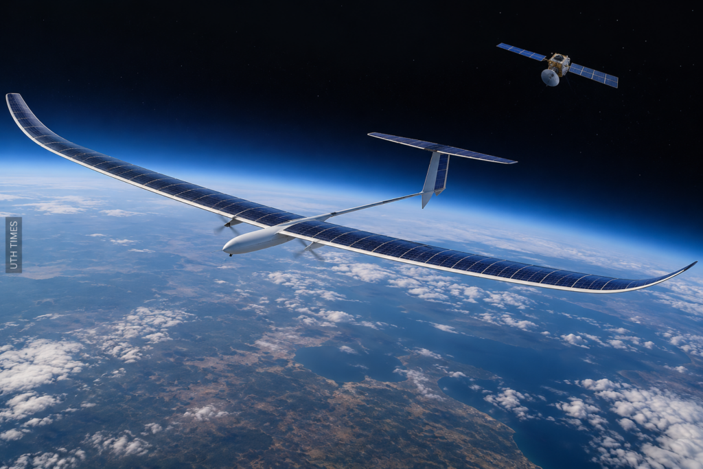
A High-Altitude Pseudo-Satellite is neither a traditional satellite nor a conventional aircraft.
🔹 It operates in the stratosphere, typically 18–25 kilometers above Earth.
🔹 It is powered primarily by solar energy, allowing it to stay airborne for weeks or even months.
🔹 Unlike satellites, it can be deployed quickly and maintained at a significantly lower cost.
🔹 Unlike drones, it can cover vast areas continuously without frequent refueling or landing.
Think of it as a “satellite in the sky” that offers the flexibility of an aircraft and the persistence of a space-based platform.
🛰️ Why This Test Matters for India
The upcoming full-scale flight represents more than just a technological demonstration.
✅ It is a critical step toward reducing dependence on expensive satellite infrastructure.
✅ It could provide real-time surveillance across sensitive borders.
✅ It strengthens India’s indigenous aerospace ecosystem and strategic self-reliance.
✅ It enhances military readiness by providing continuous intelligence gathering capabilities.
In an era where information dominance is becoming as important as military strength, HAPS platforms could become one of India’s most valuable assets.
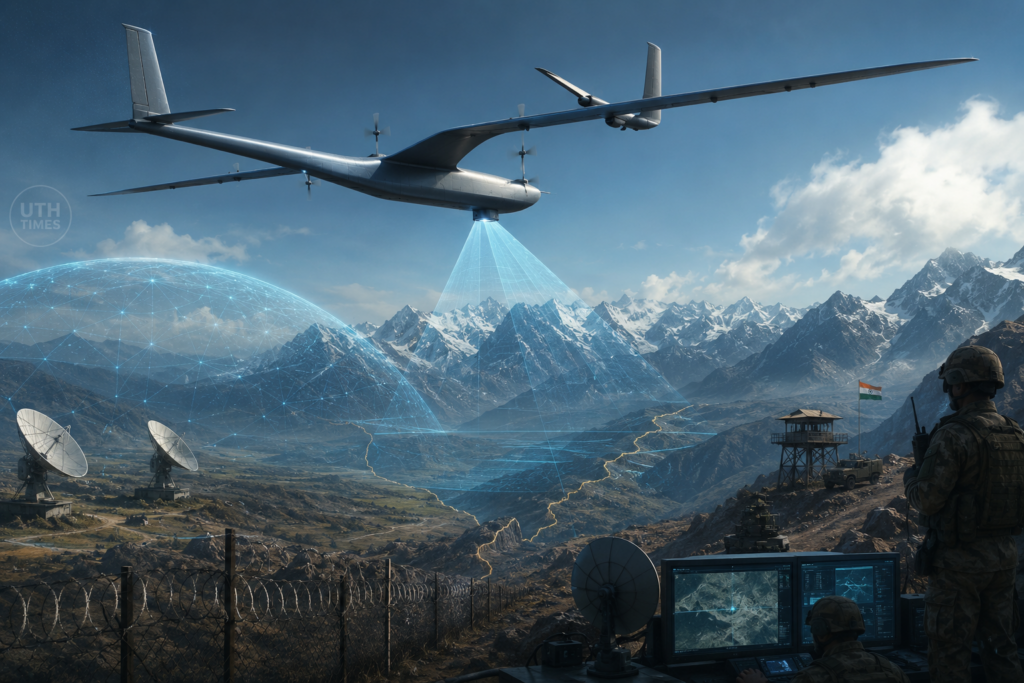
🔍 A Powerful Tool for Surveillance and Security
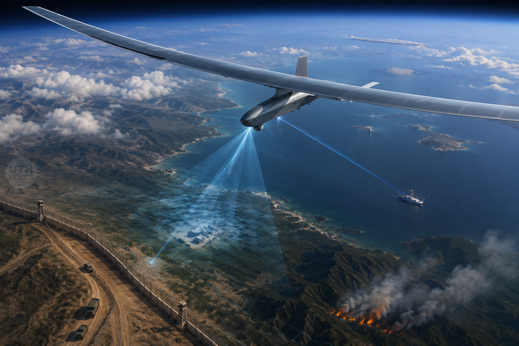
The future HAPS platform is expected to carry advanced sensors, cameras, and communication equipment.
Key Capabilities
📡 Persistent border monitoring.
📷 High-resolution imaging and reconnaissance.
🌊 Maritime surveillance across vast ocean regions.
📶 Emergency communication support during disasters.
⚡ Real-time intelligence transmission to command centers.
Because it operates much closer to Earth than satellites, it can deliver sharper imagery and faster data transfer while remaining difficult to detect.
🌏 Beyond Defence: Civilian Benefits Too
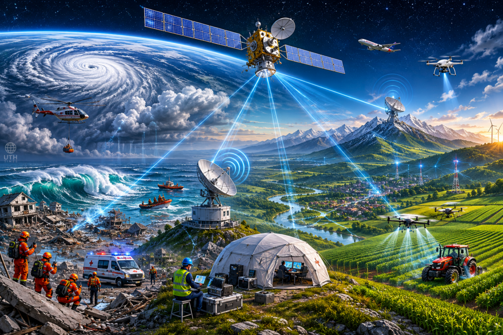
The technology is not limited to military applications.
🌦️ Weather monitoring and climate research.
🚨 Disaster management and rescue operations.
📶 Internet and communication services in remote regions.
🌾 Agricultural monitoring and environmental observation.
Such platforms could become vital tools for both national security and public welfare.
⭐ A New Chapter in India’s Aerospace Journey
India’s upcoming High-Altitude Pseudo-Satellite test is more than an aviation milestone—it is a glimpse into the future of surveillance, connectivity, and strategic technology. If successful, the project could place India among a select group of nations developing next-generation stratospheric platforms, creating a powerful new “eye in the sky” capable of watching over the nation from the edge of space.